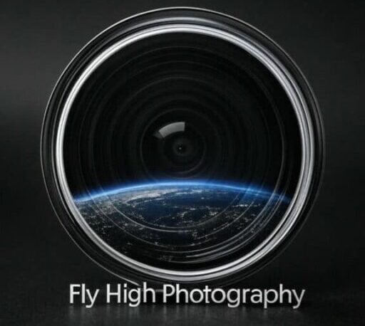

Why Choose Fly High Photography?
Fly High Photography provides aerial drone photography and video services for construction, real estate, and agriculture in Northern California. Here’s why we’re the right choice:
- Certified Expertise: Our Part 107-certified pilots ensure FAA-compliant, professional results for safe and reliable drone operations.
- High-Quality Visuals: We capture stunning aerial images for construction site monitoring, property showcases, and agricultural assessments, delivering unique perspectives that enhance your project.
- Local and Experienced: Based in Redding with nationwide experience, we blend local insight with professional expertise to highlight your business effectively.
- Marketing Impact: Our visuals boost marketing for construction progress, real estate listings, and agricultural operations, engaging your audience on any platform.
- Personalized and Eco-Friendly: We provide tailored, cost-effective solutions using eco-friendly drones, ensuring high-quality results within your budget.
Drone Services
Offering drone services to capture stunning aerial drone photography and video tailored for Northern California’s unique landscapes.
Service Catagories


Request a custom quote today to elevate your construction, real estate, or agriculture project with Fly High Photography’s expertise.
Drone Inspection Services
Request a quote Today!
Aerial Photo and Video Only Options
Photo Package
Photography Service
Includes: Photo’s Only
Travel fee for 1 location up to 10 miles from Redding, CA.
Up to 1 hour photo session.
Total of 4-6 digitally delivered enhanced aerial photos.
Additional photos = $18.99 Each.
Video Package
Videography Service
Includes: Video Only
Travel fee for 1 location up to 10 miles from Redding, CA.
Up to 2 hour photo session.
2 Digitally enhanced video clips up to 3 mins each.
Additional editing = $24.99/Hour.
Include Photos for additonal 14.99 Each.
Additional Information about Specialty Service Options
Timelapse/Hyperlapse shots – Over a length of time
Timelapse and Hyperlapse Services
Fly High Photography’s timelapse and hyperlapse services capture dynamic progression videos for construction, real estate, and agriculture in Northern California. We create automated flight plans and schedule recurring flights (weekly, biweekly, or monthly) to track construction stages, property development, or seasonal crop changes. Hyperlapse videos showcase project progress, seasonal shifts, or day-to-night transitions, ideal for monitoring construction steps, assessing agricultural crop health to maximize yield, or highlighting real estate transformations. Hyperlapse services start at $149/hour flight time plus travel, with discounted travel fees for multiple trips. Contact us today to get a detailed quote for your project.
3D Modeling
3D Modeling Services
Fly High Photography offers 3D modeling services using drone footage for construction, real estate, and agriculture in Northern California. Our drones capture high-resolution aerial images to create detailed, accurate 3D models for construction site planning, property visualization, or agricultural land analysis. These models aid in project monitoring, design, and crop management. 3D and topgraphical terrain/vegitation drone services start at $199/hour flight time plus travel, with discounted travel fees for recurring visits.


Promote Your Business with Drone Images
Aerial Video Services for Construction, Real Estate, Agriculture, and more,…
Give your business a marketing/advertising boost in Redding California and the North State with Fly High Photography’s creative marketing content. Fly High Photo specializes in construction, real estate, and agriculture in Northern California, showcasing projects from unique perspectives. Our videos highlight:
- Stunning Landscapes: Capturing Northern California’s rolling hills, forests, and coastlines to enhance construction site visuals, property listings, and agricultural assessments.
- Local Businesses and Projects: Featuring small businesses and noteworthy projects to boost visibility and community pride.
- Historical Sites: Showcasing the region’s rich history with dynamic aerial footage.
- Cinematic and Progression Footage: Delivering cinematic, dynamic videos and time-lapse progression footage over seasons or project timelines to showcase development and beauty.
Our high-quality videos promote your construction progress, real estate properties, or agricultural operations, engaging audiences effectively.
Contact us for tailored aerial video solutions.
Experience modern and clean visuals through stunning aerial drone photography and video services.
Additional Service Options
Fly High Photography offers aerial drone photography and video for construction, real estate, and agriculture in Northern California, along with:
- Photo/Video Editing: Enhancing visuals and raw photos for professional results.
- Advanced Mapping: Providing 3D models, orthomosaic maps, photogrammetry, and infrared/thermal imaging for detailed project data.
- Inspections: Conducting defensible space and utility/solar inspections for safety and compliance.
- Marketing Solutions: Creating website designs and marketing/social media content to boost your online presence.
- Agricultural Services: Offering crop monitoring and commercial spray applications. (Additional equipement required)
- Recreational Lessons: Teaching drone flying for hobbyists.
Contact us to elevate your project with our tailored services.

Captivating Aerial Visuals
Transforming your perspective with breathtaking drone photography and videography.
Gallery Showcase
Client Feedback
”Fly High Photography captured stunning aerial shots for our event. Highly recommend their services!”
”The drone footage exceeded our expectations. Professional and easy to work with!”
”We were thrilled with the quality of the photos and videos. A fantastic experience overall!”
Get a Quote! or View Store.
service notes:
Fly High Photography Service Details
Our service packages for construction, real estate, and agriculture in Northern California include:
- Local Travel: No charge for locations within 10 miles of Redding; $0.60 per mile beyond that.
- Fast Delivery: Final photos and videos delivered within 72 hours via email.
- Commercial Rights: Paid delivery includes rights to modify and distribute photos commercially.
- Licenses and Permits: We maintain all required licenses; customers cover any additional location-specific permit fees, with costs communicated upfront.
- Editing: Packages include alotted photo/video editing time; additional enhancements available at $24.99/hour.
- Scheduling: Sessions depend on availability, weather, and permits, with potential delays due to restrictions.
- Payment: Due at the time of service, customers can expect a digital invoice e-mailed once the session is complete.
All content © 2025 Fly High Photography. Personal use of digital downloads is allowed with limited rights; commercial use requires written permission. Contact us for inquiries.